Places to Visit
A forested mountain on the southern edge of Seoul offering beginner-to-intermediate trails reachable from Gangnam in under 30 minutes via the Sinbundang Line. Free entry, year-round access.
From Your Hotel Area
→ Cheonggyesan Mountain청계산
→ Isukbong Peak이수봉
→ Maebong Peak매봉
→ Wonteogol Trailhead원터골 입구
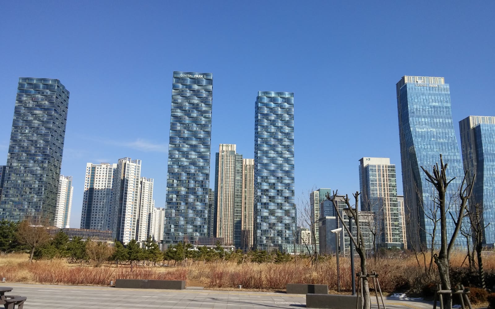
Gangnam is one of Seoul's busiest, most built-up districts — glass towers, underground malls, rooftop bars. What most visitors don't realise is that a forested mountain sits just 20 to 30 minutes away by direct subway. Cheonggyesan (청계산, literally "clear stream mountain") rises along the southern edge of Seoul into Gyeonggi Province, and thanks to the Sinbundang Line running directly from Gangnam Station, it is the easiest mountain to reach from the city's southern half. No transfers, no buses, no complicated connections — just board at Gangnam and step off at Cheonggyesan Station.
This is not a dramatic summit hike. Cheonggyesan's highest peak, Maebong, tops out at 582m — roughly two-thirds the height of Bukhansan's Baegundae. The trails are wider and more forested than Bukhansan's granite ridgelines, the crowds are lighter even on autumn weekends, and the difficulty sits firmly in the beginner-to-intermediate range. First-time hikers in Korea, families, and Gangnam office workers looking to decompress after work all find Cheonggyesan a natural fit. This guide covers the three main trails, step-by-step directions on the Sinbundang Line, what to pack, the best seasons to visit, and what to do after the hike.
Why Cheonggyesan? What Makes It Different from Other Seoul Mountains
Seoul has no shortage of hiking options. Bukhansan to the north, Gwanaksan to the southwest, Acha to the east. Cheonggyesan's competitive advantage is simple: Sinbundang Line access from Gangnam in 20 minutes, with no transfers required. For anyone based in Gangnam, Seocho, Bundang, or Pangyo — or visiting the southern half of the city — this cuts travel time by half compared to Bukhansan.
Beyond convenience, Cheonggyesan has a character that suits newer hikers well. The trails through the Wonteogol valley are shaded and gradual. There are no exposed granite scrambles or fixed-rope sections on the standard routes. The forest is thick enough to feel genuinely removed from the city even in the lower sections, and the stream running through Wonteogol valley provides a pleasant soundtrack for the first hour of the ascent. If you have done Bukhansan and found it too busy or too steep, Cheonggyesan is the natural next mountain on the Seoul list. If you have not hiked in Korea before, this is one of the better places to start.
Note: Cheonggyesan (청계산) is a completely different place from Cheonggyecheon (청계천), the famous urban stream running through central Seoul. The names are similar in English romanisation but refer to entirely separate locations — one is a mountain on the southern edge of Seoul, the other is a stream in the city centre. Search specifically for "청계산" or "Cheonggyesan hiking" to avoid confusion.
Trail Overview: Three Routes for Different Goals
Cheonggyesan has two main trailhead access points — Cheonggyesan Station (청계산역) on the Sinbundang Line, and Yangjae Citizens Forest Station (양재시민의숲역), one stop north on the same line. Most visitors use Cheonggyesan Station as the starting point. The three established routes below cover the main options for a half-day visit.
Trail A: Cheonggyesan Station → Maebong Summit (Intermediate)
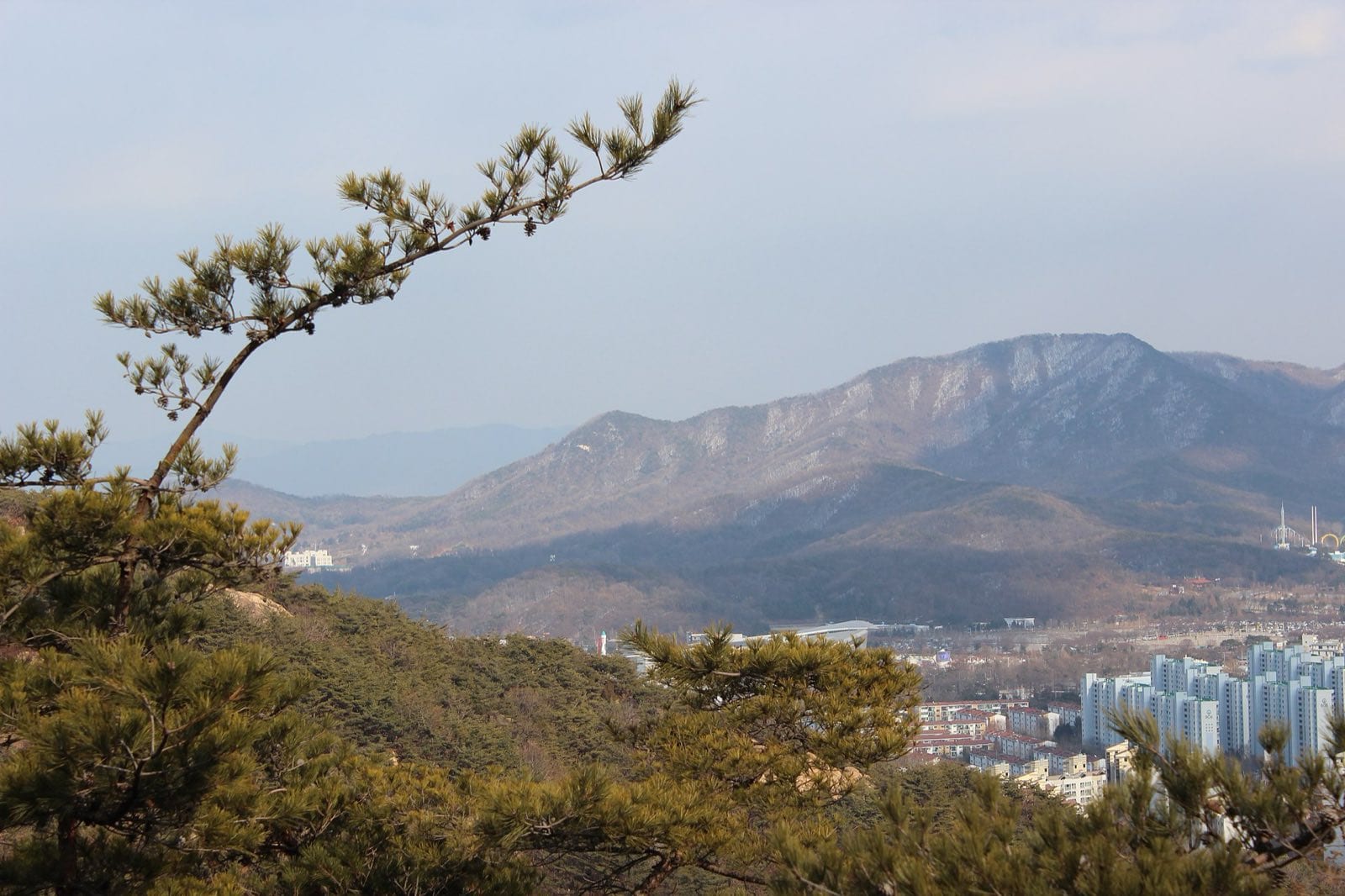
The main event at Cheonggyesan is the climb to Maebong (매봉, 582m), the mountain's highest peak. From Cheonggyesan Station Exit 1, a well-marked path leads through residential streets to the trailhead in about 10 minutes. The trail enters the forest immediately and climbs through a broad valley before ascending more steeply to the ridgeline. The upper section to Maebong involves some rocky steps and steeper gradients, but there is nothing requiring scrambling or ropes. The summit offers open views south toward Gwacheon and Uiwang, and on a clear day you can pick out the Gyeonggi plains stretching beyond the city boundary.
- Difficulty: Intermediate
- Distance: 6–8 km round trip
- Time: 2.5–4 hours
- Start: Cheonggyesan Station (Sinbundang Line, Exit 1)
- Key points: Forest valley approach, ridgeline trail, Maebong summit (582m)
Photo spot: The open ridgeline just below Maebong's summit, looking south — mountain layers receding into Gyeonggi Province. Best light in the morning before 10:00 or late afternoon when the angle is low.
Trail B: Cheonggyesan Station → Hyeorupjae Pass (Beginner / Intermediate)
Hyeorupjae (혈읍재) is a mountain pass on the ridge between Maebong and the next section of the range. The trail to Hyeorupjae from Cheonggyesan Station is shorter and less steep than the full summit route, making it the best option for those wanting a genuine mountain experience without committing to the full Maebong ascent. The pass sits at roughly 460m and provides good ridgeline views in both directions. Many hikers do Hyeorupjae as a warm-up on their first visit, then return for Maebong once they know the mountain. The round trip is manageable in 2 to 2.5 hours at a comfortable pace.
- Difficulty: Beginner / Intermediate
- Distance: 4–5 km round trip
- Time: 2–2.5 hours
- Start: Cheonggyesan Station (Sinbundang Line, Exit 1)
- Key points: Lower valley trail, Hyeorupjae pass (approx. 460m), ridgeline views
Good for: First-time mountain hikers, those with limited time, families with older children, or anyone testing fitness before committing to a full summit.
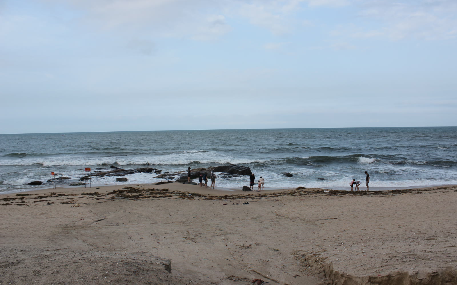
Trail C: Wonteogol Valley → Isukbong Loop (Intermediate)
The Wonteogol approach from Yangjae Citizens Forest Station is the other main entry point and has a different character from the Cheonggyesan Station routes. The Wonteogol (원터골) valley is broader and more sheltered, with a stream running through the lower section that makes the first 30 to 40 minutes of the approach particularly pleasant. From Wonteogol, the trail climbs to Isukbong (이수봉, 545m), Cheonggyesan's second-highest peak, and can be extended into a loop by descending on the Cheonggyesan Station side. The loop option makes this the most complete Cheonggyesan itinerary for those who have time for a longer day.
- Difficulty: Intermediate
- Distance: 7–9 km (loop)
- Time: 3–4 hours
- Start: Yangjae Citizens Forest Station (Sinbundang Line, Exit 5) → 15-minute walk to Wonteogol trailhead
- Key points: Wonteogol stream valley, forest ridge trail, Isukbong summit (545m), optional descent to Cheonggyesan Station
Photo spot: The stream and forest floor in Wonteogol valley — autumn colour on the valley floor with the ridge visible above. This is one of the better foliage shots in southern Seoul during late October and early November.
Getting There: Sinbundang Line from Gangnam
The Sinbundang Line (신분당선) is the key to Cheonggyesan. It runs from Gangnam Station south through Yangjae, Yangjae Citizens Forest, and Cheonggyesan — a fast, uncrowded line with relatively infrequent stops. The journey from Gangnam Station to Cheonggyesan Station takes approximately 20 minutes with zero transfers. This makes Cheonggyesan one of the most efficiently reachable mountains from central Seoul despite sitting at the city's southern boundary.
From Gangnam (강남역)
Board the Sinbundang Line at Gangnam Station. The platform is below the standard Line 2 level — follow signs for the Sinbundang Line specifically. Trains run every 5 to 7 minutes during peak hours. Ride directly to Cheonggyesan Station (청계산역), approximately 20 minutes. Exit 1. Walk 10 minutes through residential streets following hiking trail signs (등산로 표지).
For the Wonteogol route: Same line, exit one stop earlier at Yangjae Citizens Forest Station (양재시민의숲역). Exit 5. Walk approximately 15 minutes to the Wonteogol trailhead entrance.
From Myeongdong / Central Seoul (명동)
Take Line 4 to Seoul Station, transfer to Line 1 southbound to Noryangjin, then transfer to Line 9 toward Sinnonhyeon, then transfer to the Sinbundang Line at Sinnonhyeon Station southbound to Cheonggyesan. Alternatively: Line 4 to Express Bus Terminal (고속터미널), transfer to Line 3 or the Sinbundang Line connection. Total journey approximately 50 to 60 minutes. This is a longer journey from central Seoul — the mountain is genuinely oriented toward the Gangnam side of the city.
From Hongdae (홍대)
Take Line 2 from Hongik University Station to Gangnam Station (approximately 25 minutes), then transfer to the Sinbundang Line to Cheonggyesan Station (20 minutes). Total approximately 45 minutes with one transfer at Gangnam.
From Pangyo / Bundang (판교 / 분당)
Pangyo and Bundang are on the Sinbundang Line north of Cheonggyesan. From Pangyo Station, the ride to Cheonggyesan Station is approximately 10 to 15 minutes with no transfers. For Kakao, Naver, and other tech campus workers based in Pangyo, Cheonggyesan is genuinely within after-work hiking distance — arrive at the trailhead before 16:00 for a 2-hour hike with comfortable daylight remaining.
T-money and Fare
The Sinbundang Line accepts T-money and transportation cards but charges a separate fare supplement on top of the standard Seoul Metro base fare. A journey from Gangnam to Cheonggyesan typically costs ₩2,050–2,550 depending on the starting zone. Tap in and tap out as normal. See the full guide: How to Get Around Korea.
What to Expect on the Trail
Cheonggyesan's trails are well-maintained and clearly marked. The lower sections have paved or compacted gravel paths suitable for most footwear. Above the mid-mountain point, rocky steps and rooted forest floor are standard — trail shoes or hiking boots give noticeably better grip than city sneakers, especially after rain.
Facilities are good by mountain standards. There are public restrooms at the main trailhead entrances. Drinking water fountains are available at the lower trailhead areas. Vending machines selling water and sports drinks exist near the entry points. The trail is not equipped with shelters or facilities above the lower sections, so carry sufficient water before ascending.
Trail signage is primarily in Korean, but the main routes are well-worn and follow the valley contours clearly. Naver Maps and KakaoMap have accurate trail overlays for Cheonggyesan — download the route before entering areas where signal weakens. The Korea National Park Service (국립공원공단) app covers the adjacent Gwanaksan but not Cheonggyesan directly, as Cheonggyesan is managed as a Seoul metropolitan park rather than a national park.
Cheonggyesan is a popular mountain, but its trails are significantly less crowded than Bukhansan on comparable weekends. The Maebong summit route sees the most traffic; the Wonteogol valley approach and the Isukbong section tend to be quieter. Weekday visits are uncrowded at any time of year.
Dogs on leads are common on the lower sections. The mountain is generally pet-friendly below the ridgeline, though steep upper sections are not appropriate for small dogs. Check with the Seoul Metropolitan Government website for current pet access rules if this is a concern.
After the Hike: Makgeolli and Pajeon near the Trailhead
Returning from a mountain hike in Korea carries its own ritual: makgeolli (막걸리) and pajeon (파전). Makgeolli is a milky, lightly sparkling rice wine — low-alcohol, slightly sweet, served cold in metal cups or bowls. Pajeon is a savoury green onion pancake, thick and slightly crispy at the edges, usually shared between two or three people. The combination is the standard post-hike meal at virtually every mountain in Korea, and the restaurants near Cheonggyesan's trailheads uphold it.
The area around Cheonggyesan Station Exit 1 and the streets leading toward the trailhead has several traditional Korean restaurants catering directly to hikers returning from the mountain. These are typically family-run establishments with handwritten menus, no English signage, and no reservations required. Arrive hungry, point at whatever the table next to you is eating, and order one or two portions of pajeon to share. A meal of makgeolli and pajeon for two people runs ₩20,000–30,000.
The Yangjae Citizens Forest area near the station has a broader selection of restaurants, including some with English menus, given the Gangnam proximity. Doenjang jjigae (된장찌개, fermented soybean paste stew) and sanchae bibimbap (산채비빔밥, mountain vegetable bibimbap) are both common and well-suited to the post-hike mood. Budget ₩10,000–15,000 per person for a sit-down meal.
If you want a quick snack before the meal, look for pojangmacha (포장마차) vendors near the trailhead entrance. Hotteok (호떡, sweet filled pancake), fish cake skewers (어묵), and instant ramen are common. These are inexpensive (₩1,000–3,000 per item) and popular with hikers finishing the mountain in the early afternoon.
Best Time to Visit
Cheonggyesan is a year-round mountain. Each season has its own character, and all four are manageable given the trail difficulty. The two peak seasons are spring and autumn — the same as every other mountain in Korea — but Cheonggyesan's lower elevation means spring flowers arrive slightly earlier and the winter conditions are less severe than at higher mountains like Bukhansan.
Spring (late March – May)
Spring is the most scenic season on Cheonggyesan. Azaleas (진달래, jindallae) bloom across the mountainside from late March through April, covering the upper slopes in pink. The Wonteogol valley fills with new foliage and the stream runs higher from snowmelt. Temperatures in the 10–18°C range are ideal for hiking — cool enough for sustained effort, warm enough to be comfortable at the summit. Late April to early May is widely considered the best single period for a Cheonggyesan visit.
Summer (June – August)
Summer brings the Korean rainy season (장마, jangma), typically running from late June through mid-July. Trail surfaces become slippery after rain and some lower valley sections may flood briefly. The post-rainy season (August) is hot and humid at low elevation but the upper forest sections remain reasonably cool under full canopy. Early morning starts (before 08:00) make summer hiking much more comfortable. Avoid the mountain immediately after heavy rainfall.
Autumn (October – November)
Autumn foliage is the second major draw. The Wonteogol valley is particularly well-regarded for autumn colour — the forest floor turns red and gold from late October, and the valley shape concentrates the foliage into a relatively compact area that photographs well. Cheonggyesan's autumn crowds are notably lighter than Bukhansan's, which makes this season easier to enjoy on weekends without the trailhead congestion that affects northern Seoul mountains.
Winter (December – February)
Winter at Cheonggyesan is manageable at lower elevation than Bukhansan. Snow coverage is less consistent and melts faster given the more southern location. On clear winter days the air quality is excellent and views from Maebong are at their sharpest. Lightweight crampons (아이젠) are still advisable after snowfall for the upper rocky sections — rental is available at trailhead gear shops for ₩2,000–3,000. The lower valley trails are walkable in normal hiking boots through most of the winter.
What to Pack
- Hiking shoes or trail shoes: Required for upper sections above the mid-mountain. The lower valley trails are manageable in clean sneakers, but trail shoes give significantly better grip on the rocky upper steps and after rain. Sandals are not appropriate for any section above the trailhead.
- Water — minimum 1.5L: Water fountains are available at the trailhead but not on the upper trail. A 500ml bottle is not enough for a Maebong summit round trip in warm weather. Carry at least 1.5L; 2L in summer.
- Snacks and energy food: Convenience stores (GS25, CU) are within 5 minutes of Cheonggyesan Station. Stock up before entering the mountain — there are no facilities on the trail above the entry area. Kimbap, trail mix, or energy bars all work well.
- Layering: The summit at 582m is noticeably cooler than the city, especially in spring and autumn. Pack a light windproof or fleece regardless of the low-elevation forecast. A light jacket packs flat and adds minimal weight.
- T-money card: For the Sinbundang Line. Note the additional fare supplement on this line versus standard Seoul Metro. See: How to Get Around Korea.
- Navigation app: Naver Maps (네이버 지도) or KakaoMap both have accurate trail data for Cheonggyesan. Download the offline map for the mountain before you leave signal range. Google Maps trail data is less reliable for Korean hiking routes.
- Sun protection: The upper ridgeline is fully exposed. Sunscreen and a hat or cap are worth carrying from spring through early autumn.
- Crampons (winter only): Available to rent at trailhead gear shops for ₩2,000–3,000 per pair. Required after snowfall for the upper rocky sections.
Frequently Asked Questions
Is Cheonggyesan suitable for beginner hikers?
Yes. The Hyeorupjae pass route (Trail B) is appropriate for most fitness levels and does not involve any technical terrain. The Maebong summit route (Trail A) is intermediate — a sustained uphill walk with some rocky steps, but no scrambling or exposed sections. If you can walk briskly for two hours without stopping, you can reach Maebong.
Is there an admission fee?
No. Cheonggyesan is a Seoul metropolitan park and entry is free. There are no entrance gates or ticket booths on the main trails. Some adjacent temple grounds may request a small voluntary donation.
How does Cheonggyesan compare to Bukhansan?
Cheonggyesan is lower (582m vs 836.5m), less crowded, and more beginner-friendly than Bukhansan. The trails are more forested and less exposed than Bukhansan's granite ridgelines. For visitors based in Gangnam, Cheonggyesan is significantly faster to reach. Bukhansan has more dramatic summit views and more historical sites (ancient fortress walls, temples), but Cheonggyesan is the better introduction to Seoul mountain hiking for most first-time visitors.
Can I hike Cheonggyesan after work?
Yes — this is one of Cheonggyesan's defining features. With a 20-minute Sinbundang Line ride from Gangnam and a 2 to 2.5 hour round trip on the Hyeorupjae route, it is possible to leave Gangnam at 15:30, complete the hike, and be back in the city by 20:00 with daylight to spare (in spring through autumn). The mountain is well-lit near the trailhead and popular with evening hikers from the surrounding residential areas. Note that trail lighting does not extend to the upper sections — start by 16:00 at the latest to ensure a daylit descent.
Is the Sinbundang Line expensive?
The Sinbundang Line charges a distance-based supplement on top of the standard Seoul Metro base fare. A journey from Gangnam to Cheonggyesan typically costs ₩2,050–2,550 total — roughly ₩500–800 more than a standard metro trip of equivalent distance. T-money and credit-linked transportation cards both work normally. See: How to Get Around Korea.
Are dogs allowed on the trails?
Dogs on leads are generally permitted on the lower trail sections and are a common sight near the trailhead. The upper rocky sections are not suitable for small dogs. Check the Seoul Metropolitan Government's current trail access rules for official pet policy, as this can change seasonally.
What is the best single-day itinerary for Cheonggyesan?
For a first visit: arrive at Cheonggyesan Station by 09:00. Walk to the trailhead (10 minutes). Take Trail A to Maebong summit (2 to 2.5 hours up). Rest at the summit (30 minutes). Descend the same route (1.5 to 2 hours). Return to the trailhead by 14:00. Lunch at one of the nearby traditional restaurants (1 hour). Back on the Sinbundang Line by 15:30. Total trip time from Gangnam: approximately 6 to 7 hours including travel and lunch.