Places to Visit
One of the world's most visited national parks per unit area, Bukhansan offers granite peaks, ancient fortress walls, and Buddhist temples reachable by Seoul subway.
From Your Hotel Area
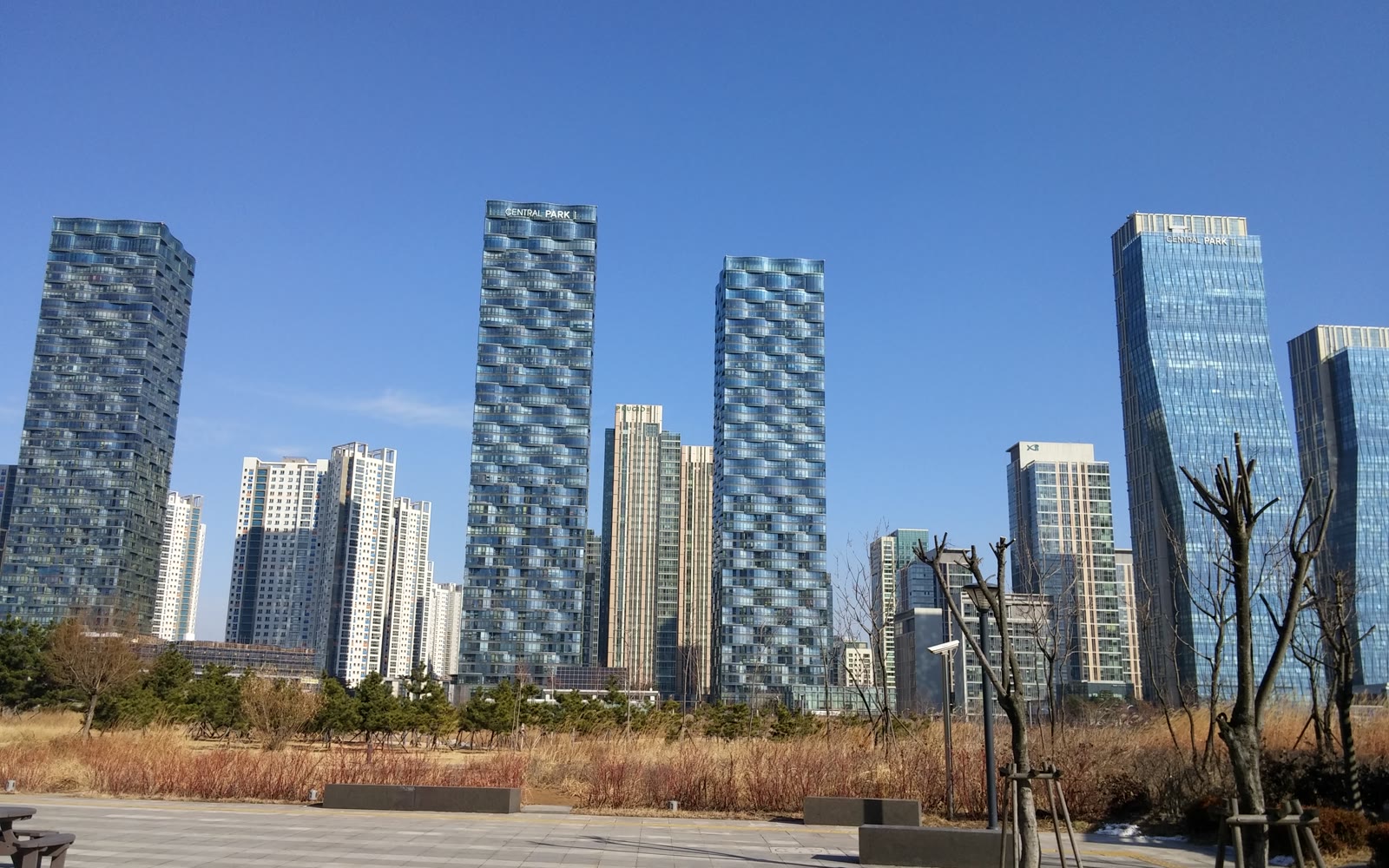
→ Bukhansan National Park북한산국립공원
→ Dobongsan Peak도봉산
→ N Seoul TowerN서울타워
→ Naksan Park낙산공원
There is a particular kind of Saturday morning in Seoul that locals know well: the subway car packed with hikers at 7 a.m., every passenger in technical layers and trail shoes, a thermos and a kimbap roll in each bag. Hiking — deungsan (등산) — is not a weekend hobby in Korea. It is closer to a national ritual. When Koreans say they are going to the mountain, they mean it the way other cultures say they are going to brunch. It is social, it is restorative, and it is taken seriously.
The good news for visitors is that Seoul happens to sit inside one of the world's most hiker-friendly urban landscapes. Seven distinct mountains and ridges are reachable from central Seoul by subway, all with free entry, and each with a different character and difficulty level. Whether you have three hours before checkout or want a full-day summit push, there is a trail here that fits. This guide compares all seven so you can pick the right one for your time, fitness level, and starting point in the city.
Why Koreans Hike: Understanding Deungsan Culture
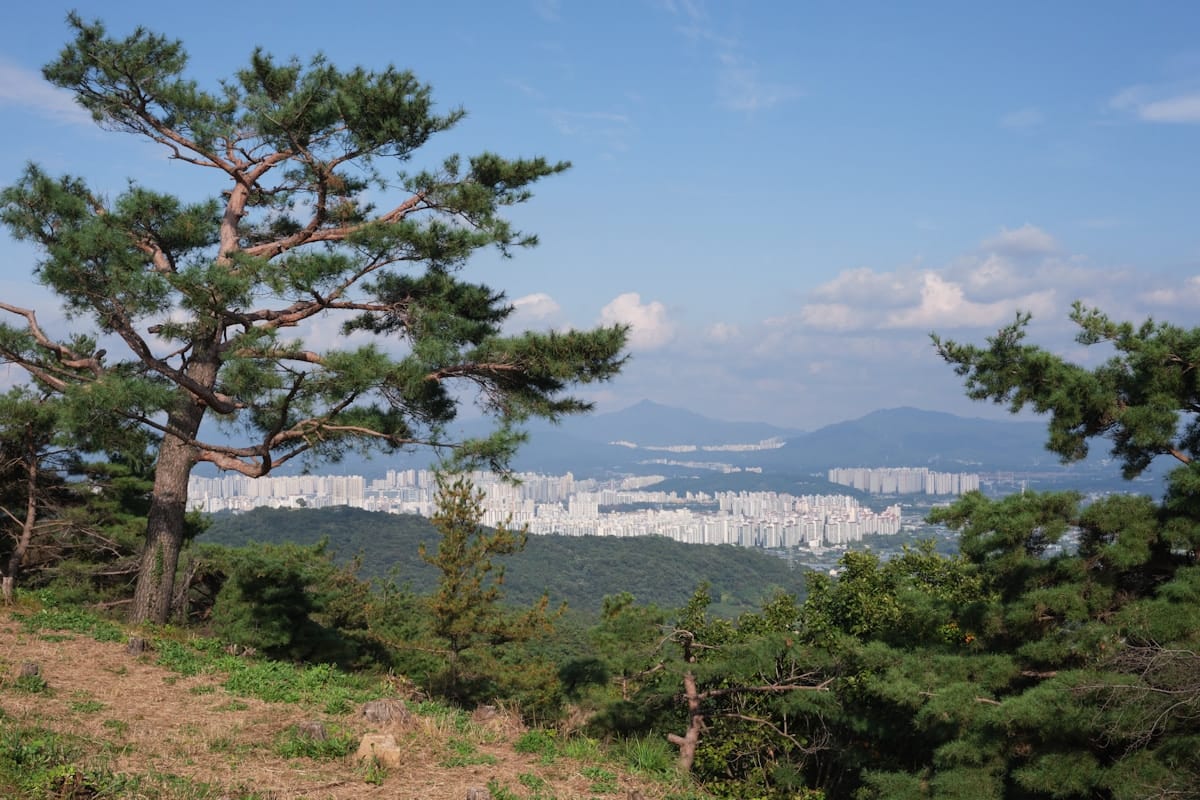
Before you pack your bag, it helps to understand what you are walking into — culturally speaking. Hiking in Korea is not an escape from city life. It is city life, just with an elevation change. The mountains around Seoul have been community spaces for centuries: Bukhansan sheltered a Joseon-era fortress, Namsan (now home to N Seoul Tower) was ringed by the city wall, Achasan marked the eastern boundary of the Hanyang capital.
Today, the mountains serve a different but equally important function. Korean hiking culture has its own dress code (full technical gear, even for a two-hour walk), its own food culture (makgeolli rice wine and pajeon pancake at the trailhead restaurants after the descent), and its own social hierarchy — the older hikers who have been doing the same route every weekend for thirty years, the younger office workers who took up trail running during the pandemic, the groups of friends in matching windbreakers.
You do not need to match the gear to enjoy the hike. But knowing that deungsan is a cultural act, not just an exercise, will make the experience richer. The mountains around Seoul are not tourist attractions. They are living parts of the city.
At a Glance — Pick Your Mountain
Seven trails, ranked from easiest to most demanding. All have free entry and Seoul Metro access.
| Mountain | Height | Difficulty | Time | Nearest Station | Best For |
|---|---|---|---|---|---|
| Naksan Park | 125m | Easy | 1–2 hrs | Hyehwa (Line 4) | City wall walk, photos, first-timers |
| Achasan | 285m | Easy | 2–3 hrs | Achasan (Line 5) | Han River sunsets, families |
| Namsan / N Seoul Tower | 262m | Easy | 2–3 hrs | Myeongdong (Line 4) | Iconic views, city centre access |
| Cheonggyesan | 582m | Intermediate | 3–4 hrs | Cheonggyesan-ipgu (Sinbundang) | Gangnam hikers, quieter trails |
| Gwanaksan | 632m | Intermediate | 4–5 hrs | Seoul Nat'l Univ. (Line 2) | Southern Seoul, granite ridges |
| Dobongsan | 739.5m | Challenging | 3–5 hrs | Dobongsan (Line 1/7) | Dramatic ridgelines, quieter than Bukhansan |
| Bukhansan (Baegundae) | 836.5m | Challenging | 4–5 hrs | Bukhansan Ui (Ui-Sinseol) | Seoul's highest accessible peak |
One rule: whatever level you choose, start earlier than feels necessary. The trails fill up fast on weekends, and the best light is always in the first two hours of the morning.
Easy Hikes: Start Here
Naksan Park — The City Wall Stroll (125m)
Naksan is less a mountain and more a hilltop park, and that is exactly its appeal. The trail follows sections of Seoul's ancient city wall — the Hanyangdoseong, originally built in 1396 — along a forested ridge between the Ikseon-dong hanok neighbourhood and the university district of Hyehwa. The walk takes an hour or two depending on how often you stop for the view, and the views across the old city toward Namsan are genuinely good.
This is the hike for the morning after a heavy night in Hongdae, for the friend who doesn't own hiking shoes, or for the afternoon when you want fresh air without committing to a full mountain day. The park has benches, lanterns, and a cafe near the entrance — it feels like a neighbourhood garden that happens to have history underfoot.
- Distance: 2–3 km loop
- Time: 1–2 hours
- Start: Hyehwa Station, Line 4, Exit 2 — follow signs to Naksan Park (10-min walk)
- Best time: Late afternoon for the golden-hour view over the rooftops of Ikseon-dong
After the walk, head down to Ikseon-dong for coffee in the hanok alleys — one of the best neighbourhood transitions in Seoul.
Achasan — Han River Sunsets and Ridge Walks (285m)
Achasan sits at the eastern edge of Seoul, where the Han River bends. It is a proper mountain walk — real trails, real elevation change, real views — without the punishing gradient of the higher peaks. The main ridge runs north to south along the river, and from the top you get a panorama that sweeps from downtown Seoul to the industrial eastern districts and the Han shining below. The sunset from Achasan is one of the most photographed in the city, and on clear days you can see as far as Namsan Tower in the distance.
The trail system connects to Yongmasan to the north, so fit hikers can extend the day into a longer ridge traverse. But even the straightforward Achasan loop is satisfying on its own. Weekends bring families and couples; weekday mornings bring the older regulars who have been doing this route for decades.
- Distance: 4–6 km (loop)
- Time: 2–3 hours
- Start: Achasan Station, Line 5, Exit 2 — follow trail signs from the exit (5-min walk to trailhead)
- Best time: Late afternoon (arrive at summit by 5 p.m. for sunset)
- Extension: Continue north to Yongmasan (348m) for a full ridge day — add 2 hours
The area near the trailhead has good dakgalbi (닭갈비, spicy stir-fried chicken) restaurants if you want a post-hike meal in the neighbourhood rather than heading back into the centre.
Namsan / N Seoul Tower — The Iconic Option (262m)
Namsan is the mountain everyone passes through without quite realising they are hiking. The hill sits in the centre of Seoul with N Seoul Tower on its summit, and the walking paths spiralling up through pine and cherry trees are among the most walked in the city year-round. It is not a wilderness experience — the summit has cafes, a cable car, the famous lock-wall — but the forested paths on the way up, especially from the Namsangol Hanok Village side, are quieter than you might expect.
For visitors, Namsan works well as a first-day orientation hike: you get a city panorama from 480m (tower observation deck), you walk through real trees, and you end up at one of Seoul's most recognisable landmarks. The cable car runs for those who prefer not to walk down.
- Distance: 3–5 km (depending on route)
- Time: 2–3 hours including tower visit
- Start: Myeongdong Station (Line 4) or Dongguk University Station (Line 3) — multiple trail access points
- Tower admission: ₩21,000 adults (observatory); the mountain itself is free
- Best time: Weekday mornings; avoid weekend afternoons near the tower
The tower observation deck link: see also Bukhansan for a contrasting city view from the north.
Intermediate Hikes: Ready to Earn the View
Cheonggyesan — The Gangnam Hiker's Mountain (582m)
If you are staying in Gangnam, Itaewon, or anywhere in the southern half of Seoul, Cheonggyesan is your mountain. The Sinbundang Line takes you from Gangnam Station to Cheonggyesan-ipgu Station in about 20 minutes, making this the most time-efficient serious hike from the south side of the city. The mountain sits on the Seoul-Gyeonggi border near Uiwang and Gwacheon, its highest point Maebong Peak at 582m.
The trails are well-maintained and clearly signed. The Wonteogol entrance (reached from Yangjae Citizen's Forest Station, Sinbundang Line) leads up a forested valley to the main ridge — a steady climb through oak and pine that opens to views over the Gangnam skyline to the north and the quieter Gyeonggi hills to the south. The contrast is genuinely striking: city towers on one horizon, rural ridgeline on the other.
Cheonggyesan is significantly less crowded than Bukhansan. The trails are well-suited to hikers making their first intermediate attempt, and the gradient is manageable without technical sections. During weekdays it is popular with local office workers from the tech companies in Pangyo (Samsung, Kakao, Naver all have campuses nearby) who hike after work.
- Distance: 6–8 km round trip (Wonteogol → Maebong)
- Time: 3–4 hours
- Start (Option 1): Yangjae Citizen's Forest Station (Sinbundang Line, Exit 5) → Wonteogol trailhead (15-min walk)
- Start (Option 2): Cheonggyesan-ipgu Station (Sinbundang Line, Exit 1) → Cheonggyesan main entrance
- Best time: Spring (azaleas bloom along the ridge in late April) and autumn (October foliage)
- Dedicated guide: Full Cheonggyesan Trail Guide
After the descent, the area near Yangjae has good sanchae bibimbap (산채비빔밥) restaurants — mountain vegetable bibimbap, the natural post-hike meal.
Gwanaksan — Seoul's Southern Granite Ridge (632m)
Gwanaksan anchors the southern edge of Seoul proper, rising sharply from the flatlands of Gwanak-gu with a rocky summit ridge at 632m. The mountain has a reputation as the training ground for serious Seoul hikers: the main route from Seoul National University is steep enough to feel demanding, the granite sections near the summit require some light scrambling, and the views from the top — north across the entire city, south into the Gyeonggi basin — are among the widest available from any Seoul-accessible peak.
The mountain is large enough to offer multiple trail combinations. First-timers usually take the main SNU approach (the most direct route to the ridge), while returning visitors explore the longer Gwacheon side approaches. The summit area has a military radar installation visible from below, which gives the peak an unusual silhouette on the Seoul skyline — distinctive and slightly surreal.
- Distance: 7–9 km round trip
- Time: 4–5 hours
- Start: Seoul National University Station (Line 2, Exit 3) → follow trail signs through the university campus to the mountain entrance
- Best time: Autumn (October – November) for the ridge views; avoid July–August rainy season
- Note: The upper granite section involves fixed ropes in one steep passage — not technical, but requires care in wet conditions
The SNU campus area has several good cafes and restaurants for a post-hike stop. The university neighbourhood has a different, more local feel than the tourist areas of central Seoul.
Challenging Hikes: Commit to the Summit
Dobongsan — Granite Ridgelines Without the Crowds (739.5m)
Dobongsan is Bukhansan's quieter sibling. The two peaks share a national park boundary in the northern reaches of Seoul, but Dobongsan draws fewer visitors — partly because it sits further north on Line 1 and Line 7, partly because it lacks the headline name recognition of Baegundae. That relative obscurity is its best feature.
The approach from Dobongsan Station is straightforward: a long forested valley walk through Dobonggyegok, past Cheonchuksa Temple, before the trail steepens toward the dramatic granite ridgeline at 739.5m. The upper section involves some scrambling on fixed ropes, similar in character to Bukhansan's Baegundae route but slightly less exposed. The views from the ridgeline look south across the full spread of Seoul — on clear days you can trace the Han River from east to west — and northeast into the Gyeonggi hills.
Dobongsan is also one of the best autumn foliage destinations in Seoul. The valley forests turn red and amber in October, and the combination of granite ridgelines above and colourful canopy below makes for some of the most striking mountain photography in the city.
- Distance: 6–8 km round trip
- Time: 3–5 hours
- Start: Dobongsan Station (Line 1 or Line 7, Exit 1) — trailhead 5 minutes from exit
- Key points: Dobonggyegok Valley, Cheonchuksa Temple, summit ridgeline (739.5m)
- Best time: October for foliage; early morning on weekends to avoid crowds
The stretch of samgyeopsal (삼겹살, grilled pork belly) restaurants on Dobongsan-ro near Exit 1 has been a Seoul hiking institution for decades. Post-hike grilled meat with soju here is as close to a local ritual as you can get without speaking Korean.
See also: Bukhansan Hiking Guide — the neighbouring national park peak, higher at 836.5m and the full-day summit challenge.
Bukhansan (Baegundae) — Seoul's Premier Summit (836.5m)
Bukhansan needs a guide of its own, and it has one. The short version: Baegundae at 836.5m is the highest point you can reach by Seoul subway, the most-visited national park per square kilometre in the world, and the hike that earns the most stories. The granite summit involves fixed ropes, requires a full day, and on clear mornings puts the entire Seoul skyline at your feet.
If you are choosing between Bukhansan and Dobongsan and have time for one, Bukhansan is the bigger commitment and the bigger payoff. If you want something slightly less intense with similar scenery and fewer crowds, Dobongsan is the better choice.
- Distance: 8–10 km round trip
- Time: 4–5 hours
- Start: Bukhansan Ui Station (Ui-Sinseol Line, Exit 1) or Gupabal Station (Line 3, Exit 2)
Full guide: Bukhansan Hiking Guide: Seoul's Mountain Escape — trails, directions, what to pack, and where to eat after.
The Post-Hike Ritual: Makgeolli and Pajeon
You will notice it at every trailhead in Seoul: a cluster of restaurants just outside the mountain entrance, packed with hikers still in their trail gear. This is the deungsan food culture, and it is one of the most enjoyable parts of the whole experience.
The canonical post-hike meal is makgeolli (막걸리) — a milky, lightly fizzy rice wine — with pajeon (파전), a thick green onion pancake that arrives crisp on the outside and soft in the middle. The combination has a logic to it: the wine is low in alcohol and good for rehydration (or so Korean hikers say), and the pancake is substantial enough to absorb it. The restaurants that serve this pairing are usually family-run spots with handwritten menus and no English, but pointing at neighbouring tables works fine everywhere.
Budget ₩8,000–12,000 per person at trailhead makgeolli spots. The more upscale version — sanchae bibimbap (mountain vegetable bibimbap) and doenjang jjigae (fermented soybean stew) — runs ₩12,000–15,000 and is particularly good near the Gupabal entrance of Bukhansan and the Yangjae area near Cheonggyesan.
At Dobongsan, the tradition leans toward samgyeopsal (삼겹살, grilled pork belly). The row of grilled meat restaurants on the main road near the station has been feeding post-hike groups since the 1990s. Order two portions per two people, add soju, and consider the afternoon finished.
When to Hike: A Season-by-Season Guide
Seoul's mountains change character dramatically through the year. Here is what each season looks like on the trails.
Spring (Late March – May)
The best all-round season for new hikers. Temperatures are comfortable (10–20°C at low elevation, cooler on ridgelines), the air is clearer than summer, and the lower trails bloom with cherry blossoms in late March and azaleas through April and into May. The azalea ridge on Cheonggyesan and the blossom walk near Bukhansan's Doson-sa Temple area are two of the best spring walks in Seoul. Weekends fill up fast in April — arriving before 9 a.m. makes a significant difference to the experience.
See also: Cherry Blossom Seoul Guide for timing and best viewing spots.
Autumn (October – November)
Peak season. The valley forests turn red and gold from mid-October, and the views from the ridgelines are at their clearest and most dramatic. Dobongsan and Bukhansan are particularly famous for their autumn foliage. Expect the heaviest crowds of the year on October weekends — the Baegundae summit trail at Bukhansan can have genuine queues at the fixed-rope sections. The Gupabal–Bukhansanseong route and Dobongsan are comparatively calmer alternatives.
See also: Autumn Foliage Seoul Guide for the full foliage calendar.
Winter (December – February)
Snow-covered granite peaks are spectacular and genuinely worth experiencing, but the upper sections of intermediate and challenging trails require crampons (아이젠, aijeun) after snowfall. All three major trailhead areas have gear shops that rent crampons for ₩2,000–3,000. The easy trails — Naksan, Achasan, Namsan — are manageable in winter without special equipment on clear days. Avoid attempting intermediate or challenging summit routes without crampons after snowfall.
Summer (June – August)
The rainy season (jangma, 장마) runs from late June through mid-July, and heat and humidity dominate through August. Trails are slippery during and after rain, some sections are temporarily closed after heavy rainfall, and the lower sections become genuinely uncomfortable in peak heat. Experienced Korean hikers tend to avoid the main trails in July and start before dawn in August when they do go. Easy trails like Naksan and lower Namsan remain pleasant with early morning starts.
How to Get There: Subway Access Summary
Every trail on this list is reachable by Seoul Metro with no car needed. T-money card is all you need — single rides cost ₩1,400–1,800 depending on distance. Pick up a T-money card at any subway station convenience store or vending machine.
- Naksan Park: Hyehwa Station, Line 4, Exit 2. Walk 10 minutes to park entrance.
- Achasan: Achasan Station, Line 5, Exit 2. Walk 5 minutes to trailhead.
- Namsan: Myeongdong Station, Line 4 (multiple access points). Cable car available from Myeongdong side.
- Cheonggyesan: Cheonggyesan-ipgu Station or Yangjae Citizen's Forest Station, both on the Sinbundang Line. From Gangnam Station: ~20 minutes.
- Gwanaksan: Seoul National University Station, Line 2, Exit 3. Walk through university campus to mountain entrance (~15 minutes).
- Dobongsan: Dobongsan Station, Line 1 or Line 7, Exit 1. Trailhead is 5 minutes on foot.
- Bukhansan (Baegundae): Bukhansan Ui Station, Ui-Sinseol Line, Exit 1. Or Gupabal Station, Line 3, Exit 2.
From central Seoul neighbourhoods:
- Myeongdong → Bukhansan Ui: Line 4 → Dongdaemun History & Culture Park → Line 2 → Sinseol-dong → Ui-Sinseol Line (~40 min)
- Gangnam → Cheonggyesan: Sinbundang Line direct (~20 min)
- Hongdae → Dobongsan: Line 2 → City Hall → Line 1 (~50 min)
- Itaewon → Achasan: Line 6 → Yaksu → Line 5 → Achasan (~30 min)
What to Pack
Korean hikers are famously well-equipped. You do not need to match their level for an easy trail, but the basics matter regardless of which mountain you choose.
- Footwear: Trail or hiking shoes for intermediate and challenging routes. Sneakers work on Naksan and lower Namsan. Sandals are not suitable for any trail with elevation gain.
- Water — minimum 1.5L for easy, 2L+ for intermediate/challenging: There are no reliable water sources on the upper trails. Convenience stores and small shops cluster at trailhead entrances — stock up before you start the ascent.
- Snacks: Kimbap rolls (available at convenience stores for ₩1,500–2,500) are the classic Korean trail snack. High in carbs, no mess, no waste. Stock up at the trailhead GS25 or CU.
- Layers: Summit temperatures run 5–10°C cooler than city level. A lightweight windproof or packable fleece is worth carrying regardless of the lowland forecast.
- Sun protection: The upper ridgelines offer no shade. Sunscreen and a hat matter more than they seem for the open granite sections.
- T-money card: For all subway and bus connections. See: How to Get Around Korea.
- Maps app: Naver Maps or KakaoMap navigate Korean trails far better than Google Maps. Download the Korea National Park Service app (국립공원 앱) for official trail maps and real-time conditions on Bukhansan and Dobongsan.
- Winter only — crampons: Available to rent (₩2,000–3,000) at gear shops near all major trailheads. Essential for intermediate and challenging routes after snowfall.
Frequently Asked Questions
Is entry free for all the mountains?
Yes. Every mountain listed in this guide — Naksan, Achasan, Namsan, Cheonggyesan, Gwanaksan, Dobongsan, and Bukhansan — charges no entry fee. The mountain trails themselves are public land. N Seoul Tower on Namsan charges an observatory admission fee (₩21,000), but the mountain walk to the base of the tower is free.
Which mountain is best for complete beginners or families with children?
Naksan Park is the gentlest option — minimal elevation gain, paved paths for much of the route, and a cafe near the entrance. Achasan is the next step up: a proper trail with some gradient, but nothing that requires more than average fitness. Both are suitable for children who are comfortable walking for one to two hours. Avoid intermediate and challenging trails with young children or anyone not accustomed to sustained uphill walking.
Can I hike year-round?
Yes, all the mountains in this guide stay open through winter. Easy trails are manageable on clear winter days without special equipment. For intermediate and challenging routes after snowfall, crampons are essential for the upper sections. Some trail sections on Bukhansan and Dobongsan are temporarily closed after heavy rain or during high fire-risk periods — check the Korea National Park Service website or app before visiting.
What time should I start?
For easy hikes, any morning works. For intermediate and challenging hikes on weekends, aim to reach the trailhead by 7:00–8:00 a.m. The summit trails fill up quickly from 9:00 a.m. onward, particularly on autumn weekends. Starting early also gives better light for photography and cooler temperatures for the ascent.
Do I need to speak Korean?
Not at all. The main trail signs on Bukhansan and Dobongsan (national park) include English. Naver Maps handles trail navigation in Korea better than Google Maps. The trailhead restaurants are menu-free experiences — pointing at what the table next to you ordered is fully accepted practice.
Are the mountains dog-friendly?
Dogs are permitted on most trails but must be kept on a leash. Cheonggyesan and Achasan are popular with local dog walkers. Dogs are not permitted in the inner sanctuaries of Buddhist temples on the mountain grounds. National park areas (Bukhansan, Dobongsan) have specific rules that can change — check the Korea National Park Service website for current policy before bringing a dog.